Portal:Tropical cyclones
The Tropical Cyclones Portal
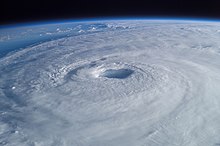
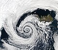
A tropical cyclone is a storm system characterized by a large low-pressure center, a closed low-level circulation and a spiral arrangement of numerous thunderstorms that produce strong winds and heavy rainfall. Tropical cyclones feed on the heat released when moist air rises, resulting in condensation of water vapor contained in the moist air. They are fueled by a different heat mechanism than other cyclonic windstorms such as Nor'easters, European windstorms and polar lows, leading to their classification as "warm core" storm systems. Most tropical cyclones originate in the doldrums, approximately ten degrees from the Equator.
The term "tropical" refers to both the geographic origin of these systems, which form almost exclusively in tropical regions of the globe, as well as to their formation in maritime tropical air masses. The term "cyclone" refers to such storms' cyclonic nature, with anticlockwise rotation in the Northern Hemisphere and clockwise rotation in the Southern Hemisphere. Depending on its location and intensity, a tropical cyclone may be referred to by names such as "hurricane", "typhoon", "tropical storm", "cyclonic storm", "tropical depression" or simply "cyclone".
Types of cyclone: 1. A "Typhoon" is a tropical cyclone located in the North-west Pacific Ocean which has the most cyclonic activity and storms occur year-round. 2. A "Hurricane" is also a tropical cyclone located at the North Atlantic Ocean or North-east Pacific Ocean which have an average storm activity and storms typically form between May 15 and November 30. 3. A "Cyclone" is a tropical cyclone that occurs in the South Pacific and Indian Oceans.
Selected named cyclone -
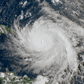
Hurricane Bud was a Category 4 hurricane that brought winds and severe flooding to Mexico throughout its existence as a tropical cyclone in June 2018. It was the second named storm, hurricane, and major hurricane of the 2018 Pacific hurricane season.[1] Bud originated from a tropical wave that departed from Western Africa on May 29. It traveled across the Atlantic Ocean before entering the Northeast Pacific Ocean late on June 6. The system moved towards the northwest and steadily organized, becoming a tropical depression on June 9 and Tropical Storm Bud early the next day. Favorable upper-level winds, ample moisture aloft, and warm sea surface temperatures allowed the storm to rapidly intensify to a hurricane late on June 10, and further to a major hurricane on the following day. Bud ultimately peaked the next morning with maximum sustained winds of 140 mph (230 km/h) and a minimum central pressure of 943 mbar (943 hPa; 27.8 inHg). Its track curved more northward while the storm rapidly succumbed to the effects of upwelling. Bud made landfall on Baja California Sur as a minimal tropical storm early on June 15. On the next day, land interaction and increasing wind shear caused Bud to degenerate into a post-tropical cyclone. It opened up into a trough of low-pressure on June 16. The remnants of Bud moved towards the Southwestern United States, bringing tropical moisture and gusty winds to the region.
Bud prompted the issuance of multiple watches and warnings for Baja California Sur and western and central Mexico. Bud caused two deaths in Mexico; one in Mexico City and another in Baja California Sur. Despite remaining offshore for most of its track, the hurricane caused torrential rainfall and severe flooding in several regions. A peak rainfall total of 6.50 in (165 mm) was recorded in San Lorenzo, Sinaloa. In Guadalajara, Jalisco, hundreds of vehicles were inundated and swept away. A canal overflowed in Guadalajara, causing damage to multiple stores in a mall. At least 100 additional structures were damaged in the city. In Guerrero, hundreds of businesses and homes were flooded. Over 100 businesses in Pie de la Cuesta were damaged by strong waves. More than 60 homes in Maruata, Michoacan, experienced flood or wind damage. Severe flooding along a street in Mexico City inundated dozens of vehicles, necessitating the rescue of their passengers. Rains from Bud's remnants brought relief to drought-stricken areas and slowed the growth of wildfires in Wyoming and Colorado. The influx of moisture prompted the issuance of flash flood watches for Colorado and New Mexico, and caused flooding near Cave Creek, Arizona. (Full article...)Selected article -
The 1970 Canada hurricane was an unnamed tropical cyclone that brought impact to Bermuda and Newfoundland. The fourth hurricane and ninth tropical storm of the annual hurricane season, this system developed northeast of the Bahamas as a subtropical depression on October 12. While tracking northeastward, the system intensified, becoming a subtropical storm on the following day. The subtropical storm transitioned into a tropical cyclone on October 16, and strengthened into a hurricane about twelve hours later. The hurricane later bypassed Bermuda, before further intensifying into a Category 2 hurricane on the Saffir–Simpson hurricane wind scale. Thereafter, the hurricane accelerated rapidly northeastward, and made landfall on the Avalon Peninsula of Newfoundland as a Category 1 hurricane. It transitioned into an extratropical cyclone early on October 17.
The system produced tropical storm force winds on Bermuda, which caused the suspension of schools, transportation, and interrupted businesses, although minimal structural damage occurred. Light rainfall was also reported on the island. Hurricane-force winds were observed throughout Newfoundland, which caused damage to structures, though mostly limited to broken windows. Rough seas damaged fishing dories and a fishing ramp on the Atlantic coast of the island. The cost of damage on the Burin Peninsula was estimated to be in the thousands of dollars, although the specific figure in unknown. Heavy rainfall was also reported in the region, with precipitation in Quebec reaching nearly 5 inches (130 mm). On the French Territory of Saint Pierre and Miquelon, several buildings and houses lost their roof due to strong winds. (Full article...)Selected image -

Selected season -

The 1996 Pacific hurricane season had below normal tropical cyclone activity, producing 9 tropical storms, of which 5 became hurricanes, with 2 of those intensifying into major hurricanes. With an Accumulated cyclone energy (ACE) index of 53.9, the season ranks among the least intense Pacific hurricane seasons on record. It officially began May 15, 1996, in the eastern north Pacific and on June 1, 1996, in the central north Pacific. It ended on November 30, 1996. These dates conventionally delimit the period of each year when most tropical cyclones form in the northeastern Pacific Ocean. The season slightly exceeded these bounds when tropical storm One-E formed on May 13.
Much of the season's activity was clustered near the coast of Southwest Mexico, with four hurricanes and one tropical storm making landfall along it. The most impactful were: Hurricane Alma, which was responsible for 20 deaths, and Hurricane Fausto, which left behind damage amounting to around $800,000 (1996 USD). Hurricane Douglas was the strongest storm of the season, reaching Category 4 intensity on the Saffir-Simpson Hurricane Scale. Douglas developed in the Caribbean Sea, within the Atlantic basin, as Hurricane Cesar, before crossing into the Pacific as a tropical storm. (Full article...)Related portals
Currently active tropical cyclones

Italicized basins are unofficial.
- North Atlantic (2024)
- No active systems
- East and Central Pacific (2024)
- No active systems
- West Pacific (2024)
- No active systems
- North Indian Ocean (2024)
- No active systems
- Mediterranean (2023–24)
- No active systems
- South-West Indian Ocean (2023–24)
- No active systems
- Australian region (2023–24)
- No active systems
- South Pacific (2023–24)
- No active systems
- South Atlantic (2023–24)
- No active systems
Last updated: 21:50, 2 June 2024 (UTC)
Tropical cyclone anniversaries

June 8
- 1960 - Typhoon Mary struck Hong Kong, killing 1,649 people across southeastern China.
- 1966 - Hurricane Alma made landfall in western Cuba causing severe flooding. The storm killed a total of 90 people and caused over $200 million of damage.

June 9
- 1934 - A hurricane struck what is now Belize after looping across Central America. The storm killed at least 516 people along its path.
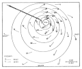
- 1989 - Typhoon Dot (track pictured) reached peak strength as a Category 3 while nearing landfall over in Hainan, causing 8 deaths and CN¥170 million (US$45.1 million) of damages.
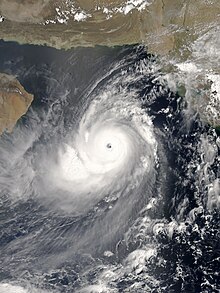
- 1998 - A cyclone struck the Indian state of Gujarat, killing at least 4,000 people.

June 10
- 1974 - Typhoon Dinah made landfall on the island of Luzon in the Philippines. Dinah killed 73 people in the Philippines, Hainan and Vietnam.
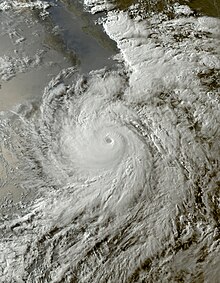
- 1991 - Cyclone Gritelle (pictured) became a named system, making it the strongest system within the south-west Indian Ocean to form in the month of June, as well as the latest in the cyclone year to be properly named.
Did you know…


- …that the Joint Typhoon Warning Center considers that Typhoon Vera (pictured) of 1986 is actually two distinct systems, formed from two separated low-level circulations?
- …that Hurricane Agatha (pictured) was the strongest Pacific hurricane to make landfall in Mexico in May since records began in 1949?
- …that Cyclone Raquel (track pictured) travelled between the Australian and South Pacific basins between the 2014–15 and 2015–16 seasons, spanning both seasons in both basins?
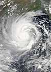
- …that Cyclone Amphan (pictured) in 2020 was the first storm to be classified as a Super Cyclonic Storm in the Bay of Bengal since 1999?
General images -
Topics
Subcategories
Related WikiProjects
WikiProject Tropical cyclones is the central point of coordination for Wikipedia's coverage of tropical cyclones. Feel free to help!
WikiProject Weather is the main center point of coordination for Wikipedia's coverage of meteorology in general, and the parent project of WikiProject Tropical cyclones. Three other branches of WikiProject Weather in particular share significant overlaps with WikiProject Tropical cyclones:
- The Non-tropical storms task force coordinates most of Wikipedia's coverage on extratropical cyclones, which tropical cyclones often transition into near the end of their lifespan.
- The Floods task force takes on the scope of flooding events all over the world, with rainfall from tropical cyclones a significant factor in many of them.
- WikiProject Severe weather documents the effects of extreme weather such as tornadoes, which landfalling tropical cyclones can produce.
Things you can do
 |
Here are some tasks awaiting attention:
|
Wikimedia
The following Wikimedia Foundation sister projects provide more on this subject:
-
Commons
Free media repository -
Wikibooks
Free textbooks and manuals -
Wikidata
Free knowledge base -
Wikinews
Free-content news -
Wikiquote
Collection of quotations -
Wikisource
Free-content library -
Wikiversity
Free learning tools -
Wikivoyage
Free travel guide -
Wiktionary
Dictionary and thesaurus
- ^ National Hurricane Center; Hurricane Research Division; Central Pacific Hurricane Center (April 26, 2024). "The Northeast and North Central Pacific hurricane database 1949–2023". United States National Oceanic and Atmospheric Administration's National Weather Service. Archived from the original on May 29, 2024. A guide on how to read the database is available here.
 This article incorporates text from this source, which is in the public domain.

